Calibrate a map with data
on map sheet
If you scanned a map or you downloaded one form the internet, you
will usually find the necessary information on the map sheet. Some
examples of a Canadian map are listed below.
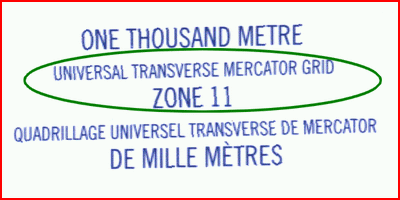
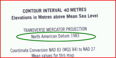
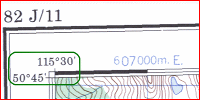
Here you see among other things the map projection UTM (pr = UTM), the UTM zone (zn = 11n) and the map datum North American Datum 1983 (dm = NAD83). In the corners of the map you will find the exact geographical coordinates of that corner points (rp = ...). These are in this case the essential data to calibrate the map.
Addition
information
A JPR-file can contain a number of
additional data. It's good to determine the map part of the sheet. This
can be done with describing the vertices (pixel coordinates vp1, vp2,
vp3, ...) starting in the top left corner then and clockwise round.
Usually, the four corners. The polygon can also be described in
geographic latitude and longitude (vg1, vg2, vg3, ...). The latter can
be useful in cases where the edges of the map long length and width
degrees walk (for example, American and Canadian cards). For further
information: see page "Introduction to
calibrate maps" .