Introduction
Sometimes downloadable maps aren't in the proper file format readable by a GPS program like Memory-Map. In most cases a graphics program does the trick; converting to the PNG format and the map is ready for calibration. In some case they doesn't. One of them are map in (geo-referenced) PDF files format, especially when they have a layer structure. In this case the PDF-XChange Editor (free version) is a powerful tool to do the job. Below you will find a workflow.
Workflow
The first step
The first step is to open the PDF file in PDF-XChange Editor and make the layer structure visible (see below).
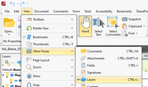
At the left bottom corner of the application you can switch between the different panes.
If the PDF file contains layers the will appear in the layer pane an you can continue to step 3. If there aren't layers go strait to the third step.
The second step
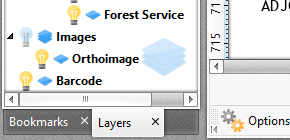
When you use PDF-XChange Editor export function, the program will export all visible layers.
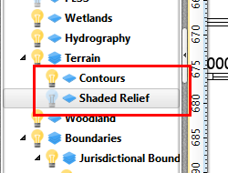
By "lightning" the "bulbs" you make layers visible. In the example above the Shades Relief isn't Visible.
The third step
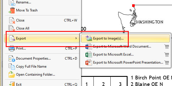
To convert a PDF map to a graphics format use the export function(red square).
In the export window you must set your parameters.
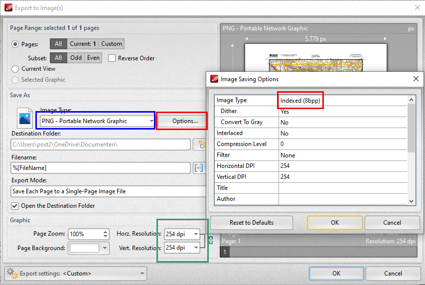
With the the "Image Type:" (blue square) you can set your the graphical format of you image. With "Options..." (red squares) you can change the color depth (8 bit per pixel is the best setting for maps). With "Horz. Resolution:" and "Vert. Resolution:" (green square) you can set the resolution of the output image. In most cases 254 dpi (100 pixel per cm) is a good option.
Before you make an attempt to calibrate you map try to load the map(image) in your GPS program. If the image doesn't , change sum parameters or chose another graphics format.
That's all!.
Updates August 10. 2021